posted by Osnat
http://www.architecture2030.org/enews/news_111412.html
--

Hurricane Sandy's path of destruction along the Jersey Shore.
$9.2 Trillion At Risk in the U.S. by 2070

The two countries with the most port assets at risk in 2070 are China and the U.S. with $10.8 trillion and $9.2 trillion respectively.
These estimates do not include the most recent assessments of sea level rise, which have increased since Architecture 2030 released its 2007 study examining coastal inundation scenarios for over 100 communities in the U.S. The findings of that report were clear: We are a Nation Under Siege. See the report and mapping here.
Five of the Top 10 Global Cities Vulnerable to
Coastal Flooding are Found in the U.S.
Coastal Flooding are Found in the U.S.

New York, NY. 3.0-meters Sea Level Rise.

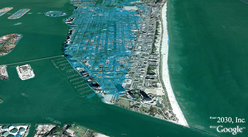
Miami Beach, FL. 1.0-meter Sea Level Rise

New Orleans, LA. 1.0-meter Sea Level Rise

Tampa, FL. 1.5-meters Sea Level Rise

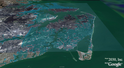
Hampton, VA. 1.0-meter Sea Level Rise
Galveston, TX and Hurricane Ike
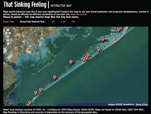
Architecture 2030’s work on mapping sea level rise for the Texas Observer for Galveston, Texas was published in Nov. 2007 – That Sinking Feeling depicted 1 meter, 1.5 meters and 2 meters of sea level rise. Ike struck Galveston ten months later, on Sep 12th 2008, pushing water up against Galveston Island, and raising sea level by over 3 meters.
Sea level rise study, That Sinking Feeling, Galveston, Texas, published, Nov. 2007, Texas Observer.

Hurricane Ike, September 12, 2008, 3:59pm EDT.

Hurricane Ike, 3-meters (9ft 10in) sea level rise, Galveston Island, September 12, 2008.
No comments:
Post a Comment